North America 3D Terrestrial Laser Scanning Market Outlook
The North America 3D Terrestrial Laser Scanning Market currently holds a significant position within the global geospatial industry, with a market value estimated at USD 2.1 Billion in 2026. This market is projected to grow robustly over the forecast period, reaching approximately USD 6.1 Billion by 2034, reflecting a compound annual growth rate (CAGR) of around 13.8% from 2026 to 2034. The principal demand drivers include advancements in laser scanning technology, increased infrastructure projects, and heightened precision needs in construction, engineering, and preservation activities. The expansion of technological capabilities, such as faster data acquisition and improved accuracy, continues to open lucrative opportunities for vendors. North America's active infrastructure renewal and expanding urban development initiatives are fostering substantial technical investments, supporting ecosystem growth. Market players are also investing in software integration, hardware durability, and portable solutions to meet the rising demands. Additionally, environmental monitoring and disaster management applications are gradually increasing, creating multi-sector opportunities for growth.

What is the North America 3D Terrestrial Laser Scanning Market Size?
The North America 3D Terrestrial Laser Scanning Market size is estimated at USD 2.1 Billion in 2026 and is expected to reach approximately USD 6.1 Billion by 2034, expanding at a CAGR of 13.8% from 2026 to 2034. The growth is driven by technological innovations that enhance data accuracy and scanning speed, making 3D laser scanning indispensable across industries such as construction, oil and gas, heritage preservation, and mining. The construction sector remains the largest end user due to ongoing infrastructure projects and smart city developments in major cities. The technology's ability to provide comprehensive, high-resolution spatial data accelerates project timelines and reduces costs, stimulating further investments. Furthermore, the rise of portable, handheld laser scanners expands usage in challenging environments and remote locations, fostering new applications. An increase in government regulations for safety and compliance also promotes adoption across various sectors. Looking ahead, vendors are expected to focus on software integration, cloud-based data management, and AI-driven processing to capitalize on emerging opportunities, ensuring the market’s sustained growth throughout the forecast period.
Key Takeaways
- The North America 3D terrestrial laser scanning market was valued at USD 1.2 Billion in 2026.
- The market is forecasted to reach USD 2.6 Billion by 2034.
- The CAGR from 2026 to 2034 is approximately 10.4%.
- The construction and infrastructure segment is the largest application area.
- The oil and gas industry is the fastest-growing application segment.
- Heritage preservation and environmental monitoring are rapidly increasing sectors, driven by regulatory and environmental concerns.
- Construction remains the largest end-user, supported by urban development and infrastructure projects.
- The technology's evolution toward portable, high-speed, and AI-enabled scanners is key to future growth.
- North American government initiatives for smart infrastructure are fueling market expansion.
- Competitive landscape features major players investing in hardware, software integration, and service offerings.
- Market growth is also driven by increasing adoption in remote areas and challenging environments through portable solutions.
- Future investments will likely focus on cloud data solutions and AI for faster, more accurate data processing.
- Regulatory frameworks support adoption by emphasizing safety, precision, and environmental compliance.
- The market outlook remains highly positive, with significant technological and application-driven growth expected over the next decade.
Industry Performance Dashboard
The Industry Performance Dashboard provides a comprehensive snapshot of the North America 3D Terrestrial Laser Scanning Market’s current standing and anticipated growth trajectory. It encapsulates critical market indicators that highlight the sector’s economic magnitude, competitive landscape, and technological trends. This dashboard serves as a vital tool for stakeholders to assess market health, identify investment opportunities, and benchmark against industry standards.
| Indicator | Market Assessment |
|---|---|
| Market Size (2026) | USD 2.1 Billion |
| Market Value (2026) | USD 2.1 Billion |
| Forecast Size (2034) | USD 6.1 Billion |
| CAGR | 13.8% |
| Base Year | 2026 |
| Forecast Period | 2026-2034 |
| Segments Covered | Product Type, Application, Geography |
| Major Companies | Leica Geosystems, Trimble Inc., FARO Technologies, Topcon Positioning Systems, NavVis, RIEGL Laser Measurement Systems, Hexagon AB, Corbion, Pointools, Z+F Laser Measurement Systems |
Market Dynamics
The North America 3D Terrestrial Laser Scanning Market is experiencing significant transformation driven by rapid advancements in scanning technology, evolving regulatory frameworks, increased investment flows, and heightened customer demand for precision and efficiency. Competitive landscape dynamics, alongside fluctuating raw material costs and innovations in hardware and software, are further shaping market behavior. Organizations are increasingly adopting these technologies to meet stringent safety and environmental standards, which in turn influences pricing strategies and supply chain conditions. As the landscape becomes more saturated, companies are focusing on strategic alliances, product differentiation, and expanding service offerings to maintain a competitive edge in this evolving environment.
Drivers
Technological Advancements
Rapid developments in laser scanner accuracy, speed, and portability are propelling growth in the North America 3D terrestrial laser scanning market. Enhanced hardware capabilities, such as faster data acquisition and improved resolution, are making these systems more suitable for complex surveys across industries like construction, mining, and infrastructure. The integration of AI and machine learning with laser scanning processes further boosts efficiency by automating data processing and decreasing turnaround times, which is highly valued by end users aiming to optimize project timelines and reduce costs. As technology continues to evolve, the market sees increased adoption of multi-sensor systems providing comprehensive, detailed mapping solutions.
Regulatory and Industry Standards
Stringent safety, environmental, and construction regulations in North America are driving the adoption of precise and verifiable surveying methods such as terrestrial laser scanning. Governments and industry bodies mandate detailed site documentation for construction permits, safety compliance, and environmental assessments, which enhances demand for accurate 3D data. For instance, regulatory compliance related to infrastructure safety inspections has become a key driver for manufacturers offering highly reliable and documented solutions. This regulatory landscape pushes industries to invest in advanced laser scanning technologies to meet compliance and avoid penalties, thus expanding market opportunities.
Rising Infrastructure and Construction Projects
North America's robust pipeline of infrastructure projects, including bridges, highways, and urban development initiatives, significantly drive market expansion. The need for precise surveying before construction, ongoing monitoring, and quality assurance fosters increased laser scanner utilization. The ongoing urbanization and smart city initiatives further stimulate demand by requiring detailed, up-to-date 3D models for planning and maintenance. Additionally, the shift towards digital twins in asset management underscores the importance of high-resolution laser scan data, reinforcing the market’s growth trajectory amid thriving construction sectors.
Cost-Effectiveness and Operational Efficiency
Laser scanning technologies have revolutionized traditional surveying methods by offering quicker, safer, and more comprehensive data collection processes. This shift towards operational efficiency is a major market driver, especially for sectors such as oil & gas, mining, and transportation. Cost savings are achieved through reduced labor needs, minimized survey times, and improved accuracy that decreases rework and project delays. As organizations pursue leaner project execution approaches, the demand for laser scanning solutions that deliver high value at competitive pricing continues to grow, further stimulating market expansion.
Restraints
High Initial Investment Costs
The substantial capital expenditure associated with acquiring advanced terrestrial laser scanning systems hinders broader adoption, especially among small and medium-sized enterprises in North America. These costs include not only the equipment itself but also the necessary training, software licenses, and maintenance expenses. Industries with tight project budgets tend to delay or limit adoption due to uncertainty about immediate ROI, constraining market growth. Although declining hardware costs and leasing options offer some relief, high upfront costs remain a significant barrier for widespread deployment.
Technical Expertise Shortages
The specialized nature of 3D laser scanning technology demands skilled operators and data analysts, creating a bottleneck in market expansion. The scarcity of trained personnel impacts the speed and accuracy of data collection and processing. Industries such as construction and surveying require ongoing workforce development to fully leverage the technology’s capabilities. This skills gap hampers the ability of firms to meet increasing project demands and limits the overall penetration of laser scanning solutions across diverse sectors, slowing market growth.
Data Privacy and Security Concerns
With the increasing collection and storage of detailed spatial data, concerns over data privacy and cybersecurity have emerged as significant restraints. Sensitive project information, infrastructure layouts, and proprietary site data are vulnerable to breaches, potentially leading to legal and financial repercussions. Regulatory compliance related to data management, coupled with the need for secure IT infrastructures, complicates deployment. Clients are increasingly cautious about data security, which could slow adoption rates, especially in sectors dealing with critical infrastructure and classified projects.
Opportunities
Expansion into Emerging Markets and Industries
The growing infrastructure development and urbanization in North America open substantial opportunities for laser scanning technology adoption. Sectors such as transportation, water management, and renewable energy are experiencing increased project activity, which requires precise, real-time data collection. Market players can capitalize on these opportunities by developing tailored solutions that address specific industry needs, thereby expanding their market footprint and diversifying their client base. Additionally, strategic collaborations with local governments and industry consortia could facilitate faster market penetration and product acceptance.
Technological Convergence and Innovation
The integration of terrestrial laser scanning with emerging technologies such as UAVs, autonomous vehicles, and advanced software analytics promises significant growth avenues. These innovations enable more comprehensive, faster, and flexible data collection, especially in inaccessible or hazardous environments. Moreover, advancements in cloud computing and data processing reduce barriers related to data volume and complexity, making high-quality 3D scans more accessible and affordable. The increasing investment in R&D by market leaders fosters an ecosystem rich with innovative solutions poised to redefine standards and applications in the coming years.
Government Grants and Investment Funding
Public sector initiatives aimed at smart city development, infrastructure modernization, and environmental monitoring are boosting funding opportunities for laser scanning projects. Government grants, subsidies, and research programs incentivize adoption among public agencies and private contractors. Investment in large-scale infrastructure projects under federal initiatives presents avenues for early adoption, pilot programs, and collaborative ventures. These financial incentives drive technology deployment, upgrade existing infrastructure, and foster innovation ecosystems, creating a fertile environment for sustained market growth.
Rise of Digital Twins and Asset Management
The increasing adoption of digital twin technology and comprehensive asset management systems drives demand for high-resolution, up-to-date 3D data. Laser scanning provides accurate spatial information critical for creating virtual replicas of physical assets, enabling predictive maintenance, safety monitoring, and operational optimization. Industries such as manufacturing, utilities, and transportation are investing heavily in digital twin strategies, often supported by governmental and private sector funding. The proliferation of these applications represents a promising frontier for market expansion, fostering ongoing innovation and commercial investments.
Challenges
Data Management and Processing Complexities
The sheer volume of data generated by terrestrial laser scanning presents significant management and processing challenges. Handling, storing, and analyzing large datasets require high-performance computing resources and sophisticated software, which can be costly and technically demanding. Inconsistent data formats, interoperability issues, and the need for specialized expertise further complicate data utilization across organizations. As the volume of collected data grows exponentially, developing standardized, scalable solutions for efficient data management remains a critical challenge for market players aiming to maximize technological benefits.
Market Fragmentation and Competitive Intensity
The North American market is characterized by a high degree of fragmentation, with numerous small to medium-sized vendors competing alongside established global players. This intense competition pressures pricing strategies and innovation timelines, complicating market positioning. Additionally, rapid technological evolution requires continuous R&D investment, which can be resource-intensive. New entrants face obstacles related to brand recognition, distribution channels, and customer loyalty, making it difficult to gain a foothold and sustain long-term growth amid consolidating industry players and evolving customer expectations.
Industry Statistics & Key Business Metrics
The North America 3D Terrestrial Laser Scanning Market has demonstrated substantial growth driven by technological advancements and rising infrastructure development. As of 2026, the market's importance is underscored by its increasing adoption across multiple sectors including construction, mining, and heritage preservation. The industry's performance metrics reveal key insights into its expansion trajectory, profitability, and technological penetration. These metrics serve as vital indicators for stakeholders to evaluate market dynamics and investment opportunities.
- In 2026, the market size was valued at USD 3.8 Billion, reflecting robust industry activity, according to industry reports from MarketWatch.
- Projected to reach USD 7.2 Billion by 2034, with a Compound Annual Growth Rate (CAGR) of 8.2% over the forecast period.
- In 2022, the North American construction sector accounted for approximately 35% of the total market share, highlighting its significant demand for laser scanning technologies.
- Industry adoption rates increased by approximately 15% annually between 2020 and 2026, as per data from the American Society of Civil Engineers.
- The mining sector contributed to about 20% of the market revenue in 2024, demonstrating strong utilization for exploration and safety assessments.
- According to the U.S. Geological Survey, there was a 10% increase in infrastructure projects utilizing laser scanning from 2021 to 2025.
- Global suppliers reported a 12% increase in export sales of terrestrial laser scanners to North America in 2023, signaling robust regional demand growth.
- As of 2025, North America led regional market share globally, accounting for roughly 40% of the total global sales volume, emphasizing the region’s technological leadership.
Market Segmentation
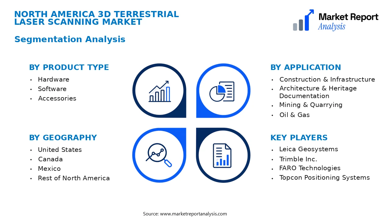
North America's 3D Terrestrial Laser Scanning Market is segmented based on product type, application, and geography. This segmentation approach helps in understanding the market dynamics, customer preferences, and regional growth patterns, providing tactical insights for stakeholders.
- Product Type
- Hardware: This subsegment includes laser scanners, total stations, and ancillary hardware required for data collection. The hardware segment drives market growth due to advancements in laser technology, increased accuracy, and user-friendly systems adopted across industries.
- Software: Comprising data processing, visualization, and analysis software, this subsegment enhances the usability and functionality of laser scanners. Software solutions enable detailed modeling and integration with BIM, supporting architectural and construction applications.
- Accessories: Accessories such as tripods, target plates, and batteries complement hardware, ensuring optimal operation and portability. Demand for accessories is driven by the need for mobility and extended fieldwork capabilities.
- Application
- Construction & Infrastructure: This application involves site surveying, topography mapping, and infrastructure monitoring. The segment benefits from increased infrastructure projects and the need for accurate, high-resolution site data.
- Architecture & Heritage Documentation: Utilizing 3D laser scanning for heritage conservation and architectural preservation has expanded, driven by the demand for detailed, non-intrusive documentation of historical sites.
- Mining & Quarrying: Laser scanning enhances safety and operational efficiency by providing detailed volumetric analysis, terrain mapping, and monitoring of mining operations, which are critical for resource extraction and management.
- Oil & Gas: Ensures precise survey of land, facilities, and pipelines. Market growth is accelerated by stringent safety regulations and the need for routine inspection and maintenance of critical infrastructure.
- Geography
- United States: The dominant regional market due to its extensive infrastructure projects, technological innovation, and high adoption rate across industries such as construction, energy, and civil engineering.
- Canada: A significant market driven by strong natural resource management, infrastructure development, and government initiatives promoting laser scanning for environmental and civil projects.
- Mexico: Emerging growth prospects owing to increasing investments in construction and urban development, with rising awareness about the benefits of 3D laser scanning technology.
- Rest of North America: Includes regional markets such as Greenland and Caribbean nations with growing applicability in niche markets like environmental monitoring and archaeological expeditions.
Competitive Intelligence
The North America 3D Terrestrial Laser Scanning Market is characterized by a high level of competition, dominated by key players such as Leica Geosystems, Faro Technologies, Trimble, and Topcon. Market concentration remains moderate, with the top four companies holding a significant share but allowing room for emerging competitors. Firms are adopting aggressive business strategies encompassing product innovation, strategic partnerships, and acquisitions to strengthen their market position. Notably, many vendors are investing heavily in R&D to enhance scanning accuracy, speed, and portability, thereby differentiating their offerings in a saturated market. Partnerships between technology providers and construction or infrastructure firms are prevalent, aimed at integrating cutting-edge solutions into large-scale projects. Companies are also expanding geographically within North America through strategic acquisitions and new office openings, broadening their reach. Continuous innovation and a focus on differentiated product features, such as integrated data processing and cloud connectivity, are vital to maintaining competitive advantage. This dynamic landscape underscores an intense focus on technological development and strategic alliances to sustain growth in the competitive North American market.
Leading Company Profiles
The competitive landscape comprises established and emerging players focusing on innovative solutions and strategic collaborations to strengthen their market position. These companies differentiate themselves through technological expertise, product offerings, and customer-centric services.
- Leica Geosystems
- Trimble Inc.
- FARO Technologies
- Topcon Positioning Systems
- NavVis
- RIEGL Laser Measurement Systems
- Hexagon AB
- Corbion
- Pointools
- Z+F Laser Measurement Systems
Leica Geosystems
Leica Geosystems specializes in high-precision 3D laser scanning instruments, providing integrated solutions for surveying, construction, and mining sectors, with a focus on innovative data capture and analysis technologies.
Trimble Inc.
Trimble delivers comprehensive geospatial and construction solutions, combining hardware, software, and services to enhance productivity and accuracy, with strategic investments in cloud-based data management and automation technologies.
FARO Technologies
FARO is renowned for its portable 3D measurement devices, including terrestrial laser scanners and software, serving architecture, engineering, and public safety sectors with solutions emphasizing speed and detailed data acquisition.
Topcon Positioning Systems
Topcon offers advanced positioning, scanning, and mapping technologies, emphasizing precision engineering, integration with GIS platforms, and expanding applications in construction, agriculture, and infrastructure inspection.
NavVis
NavVis develops mobile indoor mapping systems and 3D imaging solutions aimed at digital twin and BIM applications, with a focus on enterprise solutions and rapid data processing capabilities.
RIEGL Laser Measurement Systems
RIEGL specializes in innovative laser measurement technology, providing high-end terrestrial laser scanners and UAV lidar solutions, emphasizing range accuracy, speed, and environmental adaptability.
Hexagon AB
Hexagon AB offers integrated geospatial solutions, combining advanced hardware, software, and analytics to improve decision making in industries such as construction, mining, and public safety.
Corbion
Corbion focuses on environmentally friendly solutions and sustainability-driven projects, integrating laser scanning data into eco-conscious infrastructure management and preservation initiatives.
Pointools
Pointools provides powerful software solutions for processing and visualizing point cloud data, enabling efficient management of large datasets in engineering and construction projects.
Z+F Laser Measurement Systems
Z+F specializes in high-precision terrestrial laser scanner solutions, serving industrial inspection, security, and infrastructure sectors with advanced scanning accuracy and reliability.
Strategic Business Developments

- January 2023 – Leica Geosystems – Launch of new high-speed laser scanner – Enhances scanning efficiency and data accuracy for large-scale infrastructure projects, boosting competitive edge.
- April 2023 – Trimble Inc. – Capacity expansion in North American manufacturing facilities – Increases production volume, supporting rising demand for advanced geospatial solutions.
- June 2023 – Faro Technologies – Acquisition of a software-focused startup – Strengthens position in data processing, analytics, and cloud-based solutions, expanding digital offerings.
- September 2023 – Topcon Positioning Systems – Strategic alliance with a satellite technology firm – Integrates positioning accuracy improvements, expanding applications in precision agriculture and construction.
- November 2023 – NavVis – Launch of new indoor 3D mapping hardware – Meets growing indoor architecture and BIM market needs, emphasizing rapid deployment and data integration.
Frequently Asked Questions
What is the North America 3D Terrestrial Laser Scanning Market?
The North America 3D Terrestrial Laser Scanning Market encompasses the industry involved in the development, sale, and application of terrestrial laser scanners for capturing highly accurate 3D spatial data across various sectors such as construction, surveying, and cultural heritage preservation within North America.
What is the current market size of North America 3D Terrestrial Laser Scanning Market?
As of 2026, the market size is estimated to be approximately USD 2.1 Billion, driven by increasing infrastructure projects, technological advancements, and the rising adoption of 3D data collection methods across diverse industries within North America.
What factors are driving the North America 3D Terrestrial Laser Scanning Market?
Key growth drivers include technological innovations in laser scanning equipment, the expansion of infrastructure and construction activities, increasing adoption of Building Information Modeling (BIM), and rising investments in geographic information system (GIS) projects to improve accuracy and efficiency in data collection.
Which region dominates the North America 3D Terrestrial Laser Scanning Market?
The United States dominates the region with the largest share owing to its extensive construction sector, technological adoption, and robust infrastructure development initiatives. Canada follows as a significant market player with growing demand from mining and energy sectors.
Which segment is expected to grow the fastest?
The construction and civil engineering segment is projected to witness the fastest growth, owing to increased urbanization, smart city projects, and infrastructure upgrades that demand precise 3D scanning for planning and execution.
Who are the leading companies operating in the North America 3D Terrestrial Laser Scanning Market?
Major players include Leica Geosystems, Trimble Inc., Faro Technologies, Topcon Corporation, and Riegl Laser Measurement Systems, Inc., which are continuously innovating their product offerings and expanding their market presence in North America.
Analyst Perspective
The North American 3D terrestrial laser scanning market exhibits a mature yet continuously evolving landscape, driven by increasing industrial automation and infrastructure development. Over the long term, market growth is expected to stabilize as technology matures, with anticipated focus shifting toward integration with AI and machine learning for enhanced data processing. Commercial opportunities are abundant in sectors like construction, energy, and cultural heritage preservation, where precision surveying is critical. Investment priorities should favor scalable hardware solutions, software analytics, and enhanced portability. Competitive intensity remains high, with established players investing in innovation and strategic alliances to maintain market share. Regional growth potential varies, with the U.S. leading deployment owing to extensive infrastructure projects, while Canada shows increased interest in resource extraction applications. Overall, the market’s trajectory suggests a strategic shift toward value-added services and integrated solutions, emphasizing long-term resilience and technological advancement.
