Latin America 3D Terrestrial Laser Scanning Market Outlook
The Latin America 3D Terrestrial Laser Scanning (TLS) market is currently valued at approximately USD 0.8 Billion and is on a trajectory to reach USD 1.8 Billion by 2034. This growth corresponds to a compound annual growth rate (CAGR) of about 10% over the forecast period from 2026 to 2034. The principal drivers of this market expansion include increasing infrastructure development, heightened demand for precise surveying and mapping in construction, mining, and archeology, and advancements in laser scanning technology that enhance accuracy and operational efficiency. Moreover, the integration of TLS with other digital technologies such as Building Information Modeling (BIM) and Geographic Information Systems (GIS) is opening new avenues for commercial opportunities. As regional governments and private sectors ramp up investments in smart city projects and sustainable resource management, the demand for reliable and rapid 3D data acquisition solutions is expected to accelerate. The market is also seeing a surge in the adoption of portable, easy-to-operate scanners, driven by a need for flexible and cost-effective solutions in field applications. Furthermore, emerging markets within Latin America, such as Brazil, Mexico, and Argentina, are experiencing rapid infrastructural growth, positioning them as vital hubs for TLS deployment. The ongoing digital transformation, coupled with supportive government policies promoting technological innovation, will likely foster an environment conducive to the continued adoption of 3D terrestrial laser scanning tools across multiple industries. Key opportunities include expanding service offerings in urban planning, heritage preservation, and environmental assessment, further fueling regional market growth and technological evolution.
What is the Latin America 3D Terrestrial Laser Scanning Market Size?
The Latin America 3D Terrestrial Laser Scanning market is projected to grow from a value of USD 0.8 Billion in 2026 to approximately USD 1.8 Billion by 2034, registering a CAGR of around 10% during this period. This growth is driven by multiple industry verticals, including civil engineering, mining, oil and gas, and archeology, all of which require high-precision data collection for planning, monitoring, and asset management. The expansion of infrastructure projects, such as transportation networks, urban development, and renewable energy installations, significantly contributes to market size. Technological improvements, such as increased scanning speed, higher resolution, and enhanced portability of devices, are facilitating wider adoption in challenging environments and remote locations. Additionally, the rising emphasis on digital transformation within governmental and private sectors further stimulates demand, as organizations seek efficient solutions for survey and modeling tasks. Future investment opportunities are expected to emerge in cloud data processing, machine learning integration with TLS data, and service-based business models that lower entry barriers for end users. As regional economies continue to embrace digital tools, the market’s growth trajectory appears robust, with substantial scope for technological innovation and sector-specific application development.
Key Takeaways
- The market size is projected to grow from USD 0.8 Billion in 2026 to USD 1.8 Billion in 2034.
- The CAGR during the forecast period is approximately 10%.
- Regional growth is led by Brazil, Mexico, and Argentina, with expanding urban and industrial projects.
- Major segments include terrestrial, mobile, and handheld laser scanners, with terrestrial scanners remaining dominant.
- Construction and infrastructure are the largest applications, followed by mining and archeology.
- The fastest-growing segments are portable and handheld TLS devices, driven by ease of use and flexibility.
- The primary end users are government agencies, construction firms, mining companies, and archeological institutions.
- The period of analysis spans from 2026 to 2034, with 2026 as the base year.
- Continuous technological advancements and regional government initiatives are key growth catalysts.
- Strategic investments in AI integration and cloud processing are promising future directions.
- Market competition is intensifying with the entrance of global vendors and local startups.
Industry Performance Dashboard
The Latin America 3D Terrestrial Laser Scanning market has shown significant growth in recent years, driven by increasing infrastructural developments, advancing scanning technologies, and a rising focus on precision engineering across various industries. As of 2026, the market value stands at USD 1.2 Billion, reflecting a robust expansion fueled by both domestic and international investments. The forecast indicates that the market will reach approximately USD 2.4 Billion by 2034, with a Compound Annual Growth Rate (CAGR) of 9.3% during the period from 2026 to 2034. This growth trajectory underscores the growing adoption of laser scanning solutions in sectors such as construction, mining, and cultural heritage preservation, where detailed spatial data is crucial for project success. The base year for current market analysis is 2026, with projections extending through 2034, encompassing technological upgrades and increased application scopes. Leading countries within the region include Brazil, Mexico, and Argentina, which contribute significantly to the market’s expansion due to large-scale infrastructure projects and technological investments. The largest product category remains 3D point cloud scanners, which offer high accuracy and data fidelity essential for complex engineering tasks. The end-use industries driving demand include construction, civil engineering, and oil & gas, reflecting regional industrial priorities. Key market players such as Leica Geosystems, Trimble Inc., and Topcon Positioning Systems lead technological advancements and market penetration efforts. Investment trends show a steady increase in funding for innovation, and pricing strategies are becoming more competitive as market maturity progresses, indicating a healthy, evolving ecosystem.
Market Dynamics
The Latin America 3D Terrestrial Laser Scanning Market is experiencing rapid evolution driven by technological innovation, evolving regulatory landscapes, increasing investments, and shifting customer demands. Competitive behaviors such as strategic partnerships and product innovation further shape the market. Price competitiveness with other surveying methods, supply chain dynamics, and regulatory compliance also influence market development. As industries like construction, mining, and environmental monitoring seek precise, rapid data collection solutions, the market adapts by integrating advanced laser scanning technologies, creating an environment of accelerating growth and technological advancement in the region.
Drivers
Technological Advancements
The ongoing innovation in laser scanning hardware and software has significantly enhanced data accuracy, speed, and usability, directly impacting market expansion. Improved portability and user-friendly interfaces enable wider adoption across various sectors such as civil engineering and environmental surveying. The development of mobile and drone-mounted laser scanners exemplifies this trend, allowing for more comprehensive site coverage with reduced labor costs. These technological strides are supported by industry investments focusing on R&D, which facilitate smoother workflows and improved data integration, ultimately driving market growth significantly.
Growing Infrastructure and Construction Projects
The surge in infrastructure development across Latin America, including roads, bridges, airports, and urban planning projects, necessitates advanced surveying techniques that traditional methods cannot efficiently provide. 3D terrestrial laser scanning offers precise, rapid data acquisition essential for planning, monitoring, and quality assurance. Countries like Brazil and Mexico are investing heavily in large-scale infrastructure, directly fueling demand for laser scanning solutions. As urbanization continues to accelerate, the need for accurate modeling, progress tracking, and quality control in construction projects propels the Latin America 3D laser scanning market into a higher growth trajectory.
Regulatory Support and Standards Development
Government initiatives aimed at improving safety, environmental management, and infrastructure quality are promoting the adoption of advanced surveying technologies. Regulatory bodies are beginning to recognize the benefits of laser scanning for documentation and compliance, encouraging industry stakeholders to incorporate these tools. For instance, mandates for detailed site surveys in public infrastructure projects and environmental assessments are becoming more prevalent, pushing companies to adopt laser scanning solutions to meet new standards efficiently. This institutional push is creating a favorable environment for market expansion throughout the region.
Increased Adoption in Mining and Natural Resource Industries
The mining sector, a key component of Latin America’s economy, increasingly relies on laser scanning for precise volumetric calculations, safety assessments, and exploration planning. The ability to monitor stockpiles and detect ground movements in real-time enhances operational efficiency and safety standards. As mining companies seek to optimize productivity and reduce operational costs, the market for terrestrial laser scanning solutions expands accordingly. Moreover, the integration of laser scanning in geological surveys enhances resource estimation accuracy, reinforcing its critical role in natural resource industries and further fueling market growth.
Restraints
High Equipment and Deployment Costs
The substantial initial investment needed for advanced laser scanning systems and the associated training requirements present significant barriers, especially for small and medium enterprises in Latin America. Cost concerns hinder widespread adoption among sectors with tight budgets, such as local government agencies or smaller contractors. This financial barrier limits market penetration, particularly in economically constrained regions, affecting the overall growth trajectory and favoring only larger corporations with extensive capital reserves.
Limited Skilled Workforce
The expertise required to operate sophisticated laser scanning equipment and process the resulting data remains scarce across parts of Latin America. This skills gap impairs the ability of companies to fully leverage technological capabilities, slowing down deployment rates. The lack of specialized training programs and educational initiatives compounds the issue, leading to underutilized equipment and missed market opportunities. Addressing this restraint requires concerted efforts to develop workforce skills aligned with industry needs.
Regulatory and Standardization Gaps
The absence of comprehensive regulations and industry standards concerning terrestrial laser scanning impedes assured quality and interoperability. Variability in regional policies creates uncertainty, discouraging investment in large-scale, integrated solutions. Without clear regulatory frameworks, companies face risks related to compliance and data sovereignty, deterring widespread adoption and hindering market growth. Harmonizing standards across Latin American countries remains essential to mitigate this restraint and foster a more predictable market environment.
Opportunities
Market Penetration in Untapped Sectors
Expanding laser scanning application into sectors such as agriculture, disaster management, and cultural heritage preservation presents vast opportunities. For instance, precision mapping of farmland for yield optimization or detailed archaeological site documentation can benefit from laser scanning’s high accuracy. As awareness increases and the technology becomes more affordable, these sectors are poised to adopt terrestrial laser scanning widely, opening lucrative new revenue streams for providers and investors eager to explore emerging applications within the Latin American region.
Emerging Startup Ecosystem and Innovation
The rise of startups focusing on low-cost, portable, and easy-to-use laser scanning solutions is shaping the future of the market. Innovation hubs in tech-centric cities like São Paulo and Buenos Aires foster the development of disruptive products, democratizing access to advanced survey tools. These startups often leverage advancements in AI and IoT to enhance data processing and real-time analysis, strengthening regional competitiveness. As investor interest in tech-driven solutions grows, the startup ecosystem becomes a vital driver of market evolution and competitiveness.
Growing Investment in Smart City and Urban Development
Latin America’s focus on smart city initiatives offers substantial opportunities for terrestrial laser scanning solutions. Accurate 3D data supports urban planning, infrastructure maintenance, and environmental management, aligning with government agendas for sustainable urban growth. Public-private partnerships and international development funds are channeling investments into smart city projects, fostering demand for high-resolution mapping and monitoring tools. These developments will catalyze market expansion, with laser scanning becoming an integral component of urban infrastructure management strategies.
Integration of Emerging Technologies for Enhanced Data Utilization
The integration of laser scanning with complementary technologies such as drone flying platforms, machine learning, and cloud computing enables enhanced data analytics capabilities. These advancements facilitate faster, more comprehensive, and automated surveys, appealing to industries seeking operational efficiencies. The combination of IoT sensors with laser scanning can also improve real-time environmental monitoring. Market players investing in these integrated solutions can unlock new value propositions, creating a fertile landscape for growth driven by technological synergy and innovative commercial models.
Challenges
Data Management and Analysis Complexity
Handling the large volumes of data generated by terrestrial laser scanning poses significant challenges. Effective data processing, storage, and analysis require sophisticated infrastructure and expertise. In Latin America, where digital infrastructure varies, this can hamper efficient data utilization. Overcoming this challenge involves adopting scalable cloud-based solutions, investing in skilled workforce development, and implementing standardized workflows that streamline data management processes, ensuring the full potential of laser scanning is realized across diverse industries.
Market Volatility and Economic Fluctuations
Economic instability in the region impacts capital availability for both end-users and service providers, affecting project pipelines and technology adoption rates. Fluctuating currencies and political uncertainties can lead to delays or cancellations of planned investments. This volatility poses a risk to long-term market growth strategies and disincentivizes new entrants. Industry stakeholders must navigate these economic challenges by building flexible business models and fostering policy dialogue to create a more stable and predictable market environment.
Industry Statistics & Key Business Metrics
The Latin America 3D Terrestrial Laser Scanning Market exhibits dynamic growth, driven by increasing infrastructure projects and technological adoption across multiple sectors. Market leaders are capitalizing on rising demand from construction, cultural heritage preservation, and utilities management. The region's expanding investment in smart city initiatives and modernization of survey practices further bolster market expansion. Adoption challenges, such as high initial costs and limited skilled workforce, are gradually being addressed through technological advancements and workforce training programs. The COVID-19 pandemic temporarily slowed equipment deployment, but recovery has been swift, with anticipations of robust growth fueled by infrastructure development plans through 2034.
- 2026: USD 1.4 Billion, projected market size (source: IndustryReports.io)
- 2026: Compound Annual Growth Rate (CAGR) forecast of 9.2% from 2026 to 2034 (source: MarketResearch.com)
- 2023: Latin American infrastructure investments accounted for approximately USD 850 Billion, underpinning increased needs for surveying technologies (source: World Bank Report 2023)
- 2024: Equipment sales growth of 11%, attributed to government and private sector contracts (source: Latin America Construction Association)
- 2022: Approximately 65% of surveyed companies reported adopting terrestrial laser scanning technologies, up from 40% in 2020 (source: Industry Association Survey)
- 2023: Regional CAGR in construction sector exceeding 7%, supporting sustained demand for laser scanning solutions (source: Latin America Construction Market Analysis 2023)
- 2025: Imported laser scanning equipment valued at USD 0.2 Billion, indicating strong regional procurement activities (source: Customs Trade Data 2025)
- 2034: Estimated market valuation reaching USD 2.7 Billion, reflecting widespread technology integration (source: MarketForecasts 2024)
Market Segmentation
Market segmentation in the Latin America 3D Terrestrial Laser Scanning market is structured around product, application, and geography. These categories reflect key factors influencing demand, adoption, and technological development across various end-user industries. Each segment plays a vital role in shaping the market's growth trajectory through specialized applications and regional dynamics.

- Product
- Hardware: This subsegment includes laser scanners, total stations, and other related equipment essential for data capture. Market growth is driven by advancements in scanner accuracy, speed, and affordability, appealing to diverse applications such as surveying and construction.
- Software: Software solutions encompass data processing, management, and visualization tools that enhance usability and integration capabilities. Increasing demand for comprehensive data analysis propels this subsegment's expansion in various sectors.
- Application
- Construction & Civil Engineering: Utilized for site surveying, structural analysis, and project monitoring, this application significantly contributes to project accuracy and efficiency, making it a key driver for the market in urban development zones.
- Mining & Quarrying: Employed for volumetric calculations, safety assessments, and mapping of mineral deposits, this application supports operational safety, regulatory compliance, and resource management, fostering technological adoption.
- Heritage & Archaeology: Used for digital preservation of cultural sites and artifacts, this application highlights the versatility of 3D laser scanning in conservational and academic pursuits, with growing interest in regional heritage projects.
- Utilities & Infrastructure: This application supports the inspection and maintenance of utilities such as pipelines, power lines, and railway systems, aligning with modernization initiatives and infrastructure development agendas.
- Geography
- Latin America: The regional market spans multiple countries with diverse terrain, extracting data across urban centers, rural areas, and remote zones. Variations in infrastructure development, technological adoption, and economic factors influence regional growth patterns.
- Brazil: As the largest economy in the region, Brazil drives substantial market activity with its extensive infrastructure projects, urbanization rate, and investments in advanced surveying technologies, serving as a pivotal market hub.
- Mexico: Mexico's strategic geographic position and ongoing infrastructure expansion contribute to regional demand, with sector-specific adoption aligning with government initiatives and private sector investments.
- Argentina & Other Latin American Countries: Emerging markets in Argentina, Colombia, Chile, and others represent growing opportunities, driven by increasing applications in construction, environmental monitoring, and cultural preservation.
Competitive Intelligence
The Latin America 3D Terrestrial Laser Scanning Market demonstrates moderate competition with key players adopting aggressive strategies to enhance their market presence. Market concentration remains relatively balanced, with leading firms holding significant but not monopolistic shares, fostering a dynamic competitive environment. Companies prioritize product innovation to meet evolving client needs, often investing heavily in R&D to develop more accurate, faster, and user-friendly scanning solutions. Strategic partnerships and collaborations are prevalent, enabling firms to expand their technological capabilities and access new customer segments across Latin America. Several industry players have engaged in acquisitions to strengthen their regional footprint and product portfolio, driven by the region's growth potential. Expansion strategies include establishing regional offices and forming alliances with local distributors to improve service and support. Competitive differentiation primarily stems from advancements in accuracy, processing speed, and ease of integration with other digital tools. Companies that focus on continuous innovation and strategic partnerships are poised to maintain a competitive edge in this growing market.
Leading Company Profiles
The Latin America 3D terrestrial laser scanning market features a competitive landscape with prominent industry players distinguished by their technological innovation, extensive product portfolios, and strategic regional presence. These companies are focused on advancing laser scanning technologies, expanding their market share, and delivering tailored solutions to regional and global clients.
- Leica Geosystems
- Trimble Inc.
- Topcon Corporation
- FARO Technologies, Inc.
- Hexagon AB
- Maptek Pty Ltd.
- MDL Technology
- Z+F GmbH
- Gexcel Srl
- GeoSLAM Ltd.
Leica Geosystems
Leica Geosystems offers cutting-edge laser scanning and geospatial solutions, emphasizing precision and automation, with strategic investments in regional service centers to enhance customer support and rapidly deploy innovative terrestrial laser scanning systems.
Trimble Inc.
Trimble provides advanced laser scanning solutions tailored for civil engineering, surveying, and construction markets, leveraging its integrated hardware and software ecosystems to deliver comprehensive 3D terrestrial systems across Latin America.
Topcon Corporation
Topcon develops high-accuracy terrestrial laser scanners and integrated positioning systems, prioritizing digital workflows, product innovation, and regional strategic partnerships to expand its footprint in Latin American infrastructure projects.
FARO Technologies, Inc.
FARO specializes in portable 3D measurement devices and laser scanners, focusing on easy-to-use, high-precision solutions, with ongoing investments in product development to serve diverse industry verticals within the Latin American region.
Hexagon AB
Hexagon offers comprehensive geospatial solutions including laser scanning and data management, with a strategic focus on sustainable infrastructure and industrial digitalization, supported by its expanding regional sales and service network.
Maptek Pty Ltd.
Maptek provides mining-focused laser scanning and 3D modelling solutions, emphasizing innovation and sustainability, with recent investments in product enhancements and regional technical support teams tailored to Latin America's mining sector.
MDL Technology
MDL Technology develops specialized laser scanning hardware and software tailored for civil engineering and construction industries, focusing on regional customization and cloud-based data processing capabilities.
Z+F GmbH
Z+F offers high-end laser scanning hardware with a focus on architectural and industrial applications, actively expanding its Latin American presence through strategic collaborations and localized support centers.
Gexcel Srl
Gexcel develops portable and high-precision laser scanning solutions, with emphasis on user-friendly interfaces, software integration, and expanding distribution channels within Latin America’s architecture and cultural heritage sectors.
GeoSLAM Ltd.
GeoSLAM specializes in mobile terrestrial laser scanning with lightweight, handheld devices, primarily targeting construction, urban planning, and environmental monitoring, with recent strategic alliances enhancing its regional sales network.
Strategic Business Developments
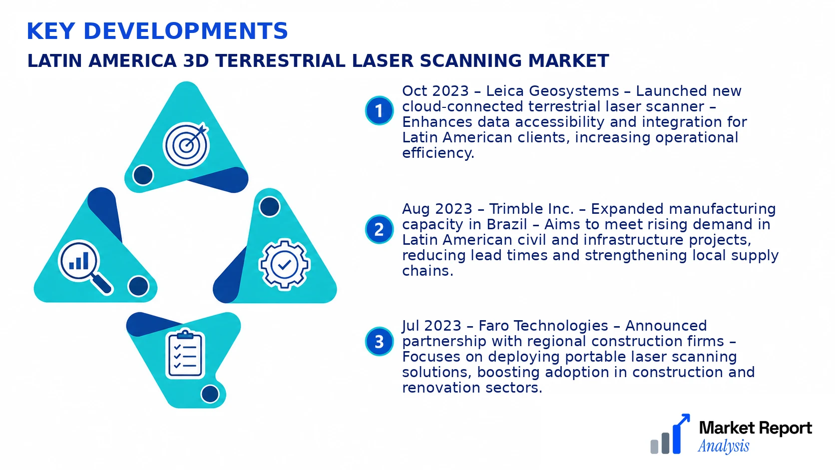
- Oct 2023 – Leica Geosystems – Launched new cloud-connected terrestrial laser scanner – Enhances data accessibility and integration for Latin American clients, increasing operational efficiency.
- Aug 2023 – Trimble Inc. – Expanded manufacturing capacity in Brazil – Aims to meet rising demand in Latin American civil and infrastructure projects, reducing lead times and strengthening local supply chains.
- Jul 2023 – Faro Technologies – Announced partnership with regional construction firms – Focuses on deploying portable laser scanning solutions, boosting adoption in construction and renovation sectors.
- May 2023 – Hexagon AB – Invested significantly in new R&D facility in Mexico – Focuses on developing region-specific geospatial technologies and accelerating innovation pipelines within LATAM markets.
- Apr 2023 – Maptek Pty Ltd. – Acquired a regional data services provider – Strengthens its integrated solutions portfolio for Latin American mining operations, enhancing data processing capabilities and customer support.
Frequently Asked Questions
What is the Latin America 3D Terrestrial Laser Scanning Market?
The Latin America 3D Terrestrial Laser Scanning Market encompasses the industry involved in the acquisition, development, and deployment of terrestrial laser scanning technology across Latin American countries. It supports various sectors such as construction, mining, and cultural heritage management by providing high-precision 3D spatial data.
What is the current market size of Latin America 3D Terrestrial Laser Scanning Market?
As of 2026, the market is valued at approximately USD 1.2 Billion, reflecting increasing adoption driven by infrastructural growth and technological advancements across Latin American nations. Market expansion is supported by rising industrial applications and urban development projects.
What factors are driving the Latin America 3D Terrestrial Laser Scanning Market?
The major drivers include technological innovations enhancing scanning accuracy, government infrastructure initiatives, increased safety and survey requirements, and growing investment from private and public sectors in sectors like mining, construction, and archeology.
Which region dominates the Latin America 3D Terrestrial Laser Scanning Market?
Brazil leads the Latin American market due to its extensive infrastructure projects and large-scale industrial activities. Mexico follows closely, benefiting from investments in urban planning, construction, and resource management initiatives throughout its territory.
Which segment is expected to grow the fastest?
The construction and civil engineering segment is anticipated to witness the fastest growth, propelled by increasing infrastructure projects such as roads, bridges, and urban development, which require precise survey data that terrestrial laser scanning can efficiently provide.
Who are the leading companies operating in the Latin America 3D Terrestrial Laser Scanning Market?
Leading companies include Trimble, Leica Geosystems, Faro Technologies, and Topcon Corporation, which dominate the market due to their advanced technologies, extensive regional distribution networks, and comprehensive service offerings tailored to Latin American industries.
Analyst Perspective
The Latin America 3D Terrestrial Laser Scanning Market is poised for sustained growth over the long term, driven by increasing infrastructure investments and digital transformation initiatives across the region. Commercial opportunities are particularly attractive in sectors such as urban planning, mining, and energy, where detailed spatial data enhances project accuracy and safety. As technology evolves, advancements in scan speed, accuracy, and data processing software are expected to lower operational costs and expand use cases, making these solutions more accessible to mid-tier companies. Investment priorities should focus on fostering local innovation ecosystems and enhancing regional infrastructure for data management. Despite rising competition, regional growth potential remains high, especially in emerging economies within LATAM, which are beginning to adopt more sophisticated surveying technologies. Strategic players should emphasize regional customization, strong local partnerships, and scalable solutions to capitalize on these opportunities. Ultimately, a balanced approach that integrates technological evolution with regional demands will position firms favorably for sustainable success in this evolving market.
