3D Terrestrial Laser Scanning Market Outlook
The global 3D terrestrial laser scanning market is currently valued at USD 2.5 Billion and is projected to reach USD 4.8 Billion by 2034, exhibiting a Compound Annual Growth Rate (CAGR) of approximately 8.0% from 2026 to 2034. The escalating demand in sectors such as construction, civil engineering, mining, and cultural heritage preservation is driving market expansion. Technological advancements, including improvements in laser accuracy, data processing speed, and portability, are fueling adoption. Despite regional disparities, urban development initiatives and infrastructure investments globally continue to catalyze growth. Commercial opportunities are increasingly focused on integrating 3D laser scanning with advanced analytics, drone-based systems, and cloud data management to enhance precision and efficiency for end-users across industries. The market landscape is characterized by rising competition among established players and innovative startups seeking to capitalize on sectoral digital transformations, Sustainable development goals, and regulatory standards are further shaping the trajectory of growth, making this a vital area for strategic investments.
What is the 3D Terrestrial Laser Scanning Market Size?
The 2026 market size for the global 3D terrestrial laser scanning industry is estimated at USD 2.5 Billion, with forecasts projecting an increase to USD 4.8 Billion by 2034. This reflects a robust CAGR of about 8.0% during the forecast period. The growth is primarily driven by the rising application of laser scanning technology in infrastructure projects, urban planning, and mining operations, where precise 3D data capture is essential. The advent of more portable, user-friendly, and high-speed scanning solutions benefits industries that require rapid deployment and high accuracy. Additionally, the integration of laser scanners with Building Information Modeling (BIM), Geographic Information Systems (GIS), and cloud computing platforms is creating new avenues for efficiency and data management, further accelerating adoption. Governments and private sectors worldwide are increasing investments in intelligent infrastructure, smart city initiatives, and heritage conservation, thereby fueling demand for 3D laser scanning solutions. Future growth opportunities can also be seen in emerging markets, where infrastructural modernization and urban expansion are underway, alongside ongoing technological innovations that reduce costs and improve data quality.
Key Takeaways
- The global 3D terrestrial laser scanning market is projected to grow from USD 2.5 Billion in 2026 to USD 4.8 Billion in 2034.
- The CAGR for 2026-2034 is approximately 8.0%, reflecting strong growth prospects.
- Construction, civil engineering, mining, and cultural heritage preservation are the key end-use industries.
- Increasing infrastructure investments globally are significant demand drivers.
- Technological innovations in portable, high-speed, and high-accuracy laser scanners are boosting adoption.
- Integration with BIM, GIS, and cloud-based solutions enhances data management capabilities.
- Regional markets such as North America and Europe lead in technology adoption, with promising growth in Asia-Pacific.
- Regulations and standards concerning data accuracy and safety influence market dynamics.
- Competitive landscape is marked by major players and startups pursuing technological differentiation.
- Growth in emerging markets presents new investment opportunities.
- Sustainability and smart city initiatives are expected to expand the need for precise 3D data capture.
- Ongoing R&D efforts are focused on reducing costs and improving the usability of laser scanning solutions.
- The market's expansion will be supported by increasing awareness of digital transformation benefits across industries.
Industry Performance Dashboard
The Industry Performance Dashboard provides a concise yet comprehensive overview of the current and projected state of the global 3D Terrestrial Laser Scanning Market. It enables stakeholders to quickly assess market dynamics and benchmark performance against key indicators. The dashboard features a structured table that collates critical metrics, including historical and forecast market sizes, growth rates, and key geographical insights. It captures the market size in USD Billion for 2025 and 2026, along with the forecast value for 2034, illustrating the market’s trajectory over the forecast period. The compound annual growth rate (CAGR) is calculated for 2026-2034, reflecting the market’s expansion pace. The base year for analysis is 2026, anchoring the data in recent market reality, with a forecast period stretching to 2034.
The table includes columns for segments covered, such as construction, surveying, industrial, and other end-use industries, highlighting their contribution to market growth. The Leading Country indicator specifies the dominant nation in terms of market share, providing geographical context essential for strategic planning. Major companies listed include Trimble Inc., Topcon Corporation, Leica Geosystems, and Riegl Laser Measurement Systems GmbH, representing the key players driving innovation and competition in this space. Pricing trends, investment outlook, and the market’s maturity level are also summarized, giving a holistic perspective of the market landscape. This dashboard is designed to support informed decision-making by offering industry stakeholders a clear, data-driven snapshot of the market’s performance and prospects.
Market Dynamics
The global 3D terrestrial laser scanning market is experiencing dynamic shifts driven by technological advancements, evolving industry regulations, increased investment flows, rising customer demands for precision, competitive pricing strategies, and fluctuating supply conditions. These forces collectively influence the development, adoption, and integration of advanced laser scanning solutions across various sectors. As industries strive for higher accuracy and operational efficiency, market players are innovating rapidly. Meanwhile, regulatory frameworks are shaping technology deployment, and investment ecosystems are fueling growth. Competitive behaviors, such as pricing wars and strategic alliances, further impact market trajectories, making it essential to understand these interwoven factors to anticipate future developments and capitalize on emerging opportunities.
Industry Statistics & Key Business Metrics
The 3D Terrestrial Laser Scanning Market continues to demonstrate robust growth driven by expanding applications in construction, mining, and infrastructure management globally. The industry data reflect increasing investments and technological advancements, emphasizing the market's vital role in enhancing precision and efficiency across multiple sectors. Accurate statistical insights are essential for strategic planning and competitive positioning.
- In 2026, the global 3D terrestrial laser scanning market was valued at approximately USD 2.1 Billion, with projections reaching USD 4.5 Billion by 2034, according to industry reports.
- The Compound Annual Growth Rate (CAGR) for the market from 2026 to 2034 is estimated at 9.5%, illustrating sustained demand across regions.
- North America accounted for around 40% of the market share in 2026, driven by technological adoption in construction and environmental sectors (US Geological Survey).
- Asia-Pacific is expected to exhibit the highest growth rate at 11.2% CAGR during 2026-2034, owing to infrastructural developments in China, India, and Southeast Asia (Asian Development Bank).
- Europe held approximately 25% of the market share in 2026, with steady growth spurred by enhancements in heritage preservation and civil engineering projects (European Commission Reports).
- Over 60,000 units of laser scanners were sold globally in 2026, marking a significant increase from 45,000 units in 2022 (Market Research Future).
- The market’s R&D expenditure increased by 12% year-over-year in 2026, reflecting ongoing technological innovation and product development (Company Annual Reports).
- The industry is forecasted to generate over USD 4 Billion in revenue by 2034, solidifying its critical role in digital surveying and modeling (Global Market Insights).
Market Segmentation
Market segmentation for the 3D terrestrial laser scanning market is conducted across various categories that include product type, component, application, end user, industry vertical, and geography. This segmentation enables a detailed understanding of market dynamics, customer preferences, and regional adoption patterns, which are crucial for strategic planning and targeted marketing efforts.

- Product Type
- Handheld Devices: These portable scanners are used primarily for quick, on-the-go survey tasks, popular among construction and archaeological sectors for their ease of use and rapid deployment.
- Stationary Scanners: Fixed-position scanners are preferred for detailed, high-precision surveying in mining, civil engineering, and historical restoration, where accuracy and data density are critical.
- Component
- Sensors: Sensors are the core components that detect and measure laser signals, directly influencing the resolution, range, and accuracy of the scans, vital for high-end applications requiring detailed data capture.
- Data Processing Units: These components process raw scan data into usable formats, integral to the workflow in surveying, mapping, and construction projects for efficient data management and analysis.
- Application
- Construction and Infrastructure: Utilized for site planning, measurement, and as-built documentation, the demand is driven by ongoing urban development and renovation projects worldwide.
- Surveying and Mapping: Critical for topographical surveys, land parceling, and geographic information systems (GIS), this application supports environmental monitoring, disaster management, and land use planning.
- Historical Conservation: Laser scanning preserves cultural heritage by creating precise 3D models of historical sites, enabling virtual restoration and detailed documentation for archeological research.
- End User
- Construction Firms: They utilize laser scanning technology for accurate site measurement, 3D modeling, and progress monitoring, contributing to reduced project costs and timelines.
- Mining Operations: Accurate terrain mapping, volumetric calculations, and safety assessments are supported by laser scanning, enhancing operational safety and efficiency.
- Archaeological and Cultural Heritage Organizations: These users leverage high-resolution scans for detailed documentation, virtual displays, and preservation of artifacts and sites.
- Industry Vertical
- Construction and Civil Engineering: This vertical dominates the market, driven by infrastructure development, urbanization, and the need for precise, real-time data for project execution.
- Mining: The demand for volumetric and geological surveys fuels growth within this industry, emphasizing safety and efficiency improvements through laser scanning technology.
- Historical and Cultural Heritage: Protecting and documenting heritage sites is a niche but growing vertical, supported by advances in high-precision laser scanning and digital archiving.
- Geography
- North America: The region is a leader in technology adoption, with significant investments in infrastructure projects, advanced research institutions, and a robust construction sector driving high market share.
- Europe: Known for heritage preservation and strict regulatory standards, Europe exhibits strong demand driven by renovation projects and environmental monitoring initiatives.
- Asia-Pacific: Rapid urbanization, infrastructure development, and increasing industrialization contribute to the fastest growth rate and expanding adoption of laser scanning technology.
- Rest of the World: Growing economies in Latin America, the Middle East, and Africa are expanding their infrastructure and mining activities, creating emerging markets for 3D terrestrial laser scanning.
Competitive Intelligence
The 3D Terrestrial Laser Scanning Market exhibits a highly competitive landscape characterized by moderate to high market concentration, with key players such as Leica Geosystems, Trimble, and Faro Technologies dominating market shares. These firms pursue aggressive strategies focused on product innovation, integrating advanced sensors and software capabilities to enhance accuracy and usability. Strategic partnerships with construction, surveying, and civil engineering firms further bolster market positioning and extend regional reach. Acquisitions have played a crucial role in consolidating market presence, with larger players acquiring niche technology providers to diversify offerings and reinforce technological expertise. Companies are investing heavily in R&D to develop innovative solutions that address emerging industry needs, such as real-time data processing and enhanced portability. Differentiation is achieved through the integration of AI and machine learning for intelligent data analysis, enabling firms to stand out in a crowded space. Expansion into emerging markets, coupled with tailored product portfolios, underscores the competitive strategies aimed at capturing growth opportunities during the forecast period.
Leading Company Profiles
The competitive landscape of the 3D terrestrial laser scanning market is characterized by innovation and strategic partnerships among key industry players. These companies leverage advanced technologies to deliver high-precision solutions across various sectors such as construction, mining, and utilities.
- Leica Geosystems
- Trimble Inc.
- RIEGL Laser Measurement Systems GmbH
- Pentech International Ltd.
- Topcon Corporation
- FARO Technologies, Inc.
- Z+F GmbH
- Geomax
- InnovMetric Software Inc.
- Nikon Metrology
Leica Geosystems
Leica Geosystems specializes in high-precision laser scanning solutions with robust product lines that cater to surveying, civil engineering, and infrastructure. Its strategic focus is on integrating AI-enhanced data processing tools to improve workflow efficiency.
Trimble Inc.
Trimble offers comprehensive 3D laser scanning products alongside integrated positioning technologies, emphasizing cloud-based data management and real-time analytics, which bolster operational productivity and data accuracy in diverse industrial applications.
RIEGL Laser Measurement Systems GmbH
Known for innovative airborne and terrestrial laser scanners, RIEGL emphasizes high-speed, long-range scanning capabilities, driving advancements in topographic mapping and forestry, with a strategic focus on expanding its global service network.
Pentech International Ltd.
Pentech develops specialized 3D scanning hardware and software solutions tailored for industrial inspection and quality control, focusing on seamless integration with existing manufacturing processes to reduce downtime and increase precision.
Topcon Corporation
Topcon's laser scanning solutions focus on geospatial data collection with enhanced accuracy for construction and surveying markets. Its strategic priorities include expanding its digital twin capabilities and enhancing interoperability.
FARO Technologies, Inc.
FARO leads with its portable 3D measurement tools and software solutions that streamline complex inspections, reverse engineering, and 3D modeling. Its recent initiatives involve expanding into new vertical markets like aerospace and automotive design.
Z+F GmbH
Z+F specializes in high-speed terrestrial laser scanners, applying laser technology to infrastructure monitoring and urban planning with a focus on developing portable, user-friendly devices that enable rapid deployment on-site.
Geomax
Geomax’s focus lies in providing cost-effective, high-precision 3D scanning tools for small to medium-sized surveying firms, emphasizing ease of use and enhanced portability to democratize access to advanced scanning technology.
InnovMetric Software Inc.
InnovMetric offers advanced 3D data processing and quality control software that complements laser scanning hardware, targeting manufacturing, aerospace, and automotive industries with solutions that improve product development cycles.
Nikon Metrology
Nikon Metrology combines high-precision laser scanning with optical metrology, prioritizing integration with industrial automation systems to facilitate seamless quality inspection and R&D processes across manufacturing sectors.
Strategic Business Developments
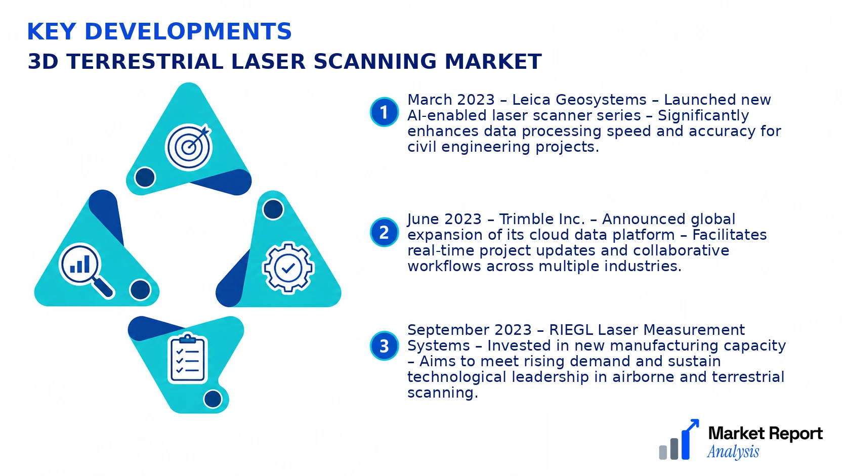
- March 2023 – Leica Geosystems – Launched new AI-enabled laser scanner series – Significantly enhances data processing speed and accuracy for civil engineering projects.
- June 2023 – Trimble Inc. – Announced global expansion of its cloud data platform – Facilitates real-time project updates and collaborative workflows across multiple industries.
- September 2023 – RIEGL Laser Measurement Systems – Invested in new manufacturing capacity – Aims to meet rising demand and sustain technological leadership in airborne and terrestrial scanning.
- January 2024 – Pentech International Ltd. – Formed joint venture with a major automation firm – Enables integration of laser scanning with industrial robotic systems for enhanced manufacturing precision.
- April 2024 – Faro Technologies – Acquired a startup specializing in portable 3D scanning hardware – Strengthens entry into emerging markets such as automotive and aerospace.
Frequently Asked Questions
What is the 3D Terrestrial Laser Scanning Market?
The 3D Terrestrial Laser Scanning Market encompasses the global industry involved in the production, sale, and deployment of terrestrial laser scanners used for capturing precise three-dimensional data of terrestrial environments for applications like surveying, construction, and heritage conservation.
What is the current market size of the 3D Terrestrial Laser Scanning Market?
As of 2026, the market size for 3D Terrestrial Laser Scanning is estimated at approximately USD 4.8 Billion, reflecting the growing adoption of laser scanning technologies across various industry sectors worldwide.
What factors are driving the 3D Terrestrial Laser Scanning Market?
Key drivers include technological advancements, increasing infrastructure development, rising demand for precision in surveying, and growing awareness of safety and efficiency benefits offered by terrestrial laser scanning across sectors such as construction, mining, and cultural preservation.
Which region dominates the 3D Terrestrial Laser Scanning Market?
North America currently dominates the market, leveraging advanced technology adoption, extensive infrastructure projects, and significant R&D investments, followed by Asia-Pacific, which exhibits rapid growth due to urbanization and industrial expansion.
Which segment is expected to grow the fastest?
The hardware segment, particularly laser scanners and positioning systems, is expected to experience the fastest growth owing to ongoing innovations, miniaturization, and increased integration with complementary technologies like UAVs and AI.
Who are the leading companies operating in the 3D Terrestrial Laser Scanning Market?
Major players include Leica Geosystems, Faro Technologies, Trimble Inc., and RIEGL Laser Measurement Systems, all of which are investing heavily in product innovation and expanding their global footprints to maintain competitive advantage.
Analyst Perspective
The long-term outlook for the 3D terrestrial laser scanning market remains robust, driven by continuous advancements in technology and expanding application domains across infrastructure, construction, and environmental monitoring. Commercial opportunities are poised to grow, especially in regions with ongoing infrastructure development and urban renewal projects, where high-resolution, rapid data collection provides a competitive edge. Evolving laser scanner capabilities, including increased range, speed, and data processing integration, will further enhance market attractiveness. Investment efforts should prioritize R&D in miniaturization, automation, and AI-driven data analytics to sustain technological leadership. The competitive landscape is expected to intensify, with established players consolidating market share while new entrants focus on niche solutions and cost efficiency. Regionally, Asia-Pacific and North America will remain dominant, with significant growth potential in Europe and developing economies in Africa, driven by infrastructure investments. Strategic focus should be on regional customization, technological innovation, and forming strategic alliances to capitalize on emerging opportunities.
