Europe 3D Terrestrial Laser Scanning Market Outlook
The Europe 3D Terrestrial Laser Scanning Market is currently valued at approximately USD 1.2 Billion and is projected to reach around USD 3.4 Billion by 2034, growing at a CAGR of 13.2% during the forecast period from 2026 to 2034. The market’s growth is driven by increasing infrastructure development, the need for precise survey data in construction, heritage preservation, and mining sectors, alongside advancements in laser scanning technology such as higher accuracy, faster data acquisition, and integration with AI and cloud computing solutions. The commercial landscape is witnessing rising adoption among surveying firms, engineering consultancies, and government agencies. Additionally, the expansion of smart city projects and environmental monitoring initiatives is creating significant demand. Innovations in portable, lightweight scanners, and software solutions that facilitate rapid data processing and real-time visualization, further propel market growth, offering new opportunities for providers to capitalize on urban planning, surveillance, and disaster management applications.
What is the Europe 3D Terrestrial Laser Scanning Market Size?
The market size for Europe’s 3D terrestrial laser scanning was valued at approximately USD 1.2 Billion in 2026 and is forecasted to reach USD 3.4 Billion by 2034, reflecting a robust CAGR of 13.2%. The growth is largely driven by technological advancements that support high-resolution, accurate measurements crucial for diverse end-use industries, such as construction, civil engineering, archaeology, and utilities management. Public infrastructure projects and private sector investments in digital twins and virtual design also act as catalysts. Furthermore, government regulations emphasizing safety, environmental compliance, and heritage conservation amplify demand. As technical innovation continues to lower costs and increase accessibility, market participants are expected to see expanding opportunities in turnkey project delivery and specialized scanning services, especially in countries with large geographic footprints and aging infrastructure needing modernization. The rising integration of terrestrial laser scanning with geo-spatial mapping, BIM, and GIS platforms enhances its predictive and analytical capabilities, making it indispensable for future infrastructural, environmental, and urban development initiatives. Overall, the market's rapidly growing size indicates a vibrant trajectory fueled by technological, regulatory, and economic factors.
Key Takeaways
- The Europe 3D terrestrial laser scanning market is valued at approximately USD 1.2 Billion in 2026 and is projected to grow at a CAGR of 13.2% through 2034.
- The forecasted market size in 2034 is roughly USD 3.4 Billion.
- The largest segment by technology is terrestrial laser scanners, with emerging handheld and mobile scanners as the fastest-growing technology types.
- The construction and civil engineering sectors represent the largest application areas, with cultural heritage preservation as the fastest-growing sector.
- Major end users include government agencies, engineering firms, and surveyors, with government-driven infrastructure projects fueling market growth.
- Market growth is driven by technological innovations, increased demand for accurate data, and regulatory emphasis on safety and sustainability.
- The scope for investment includes expanding scanner portability, integrating AI for data processing, and developing cloud-based solutions for remote access and analysis.
- European countries with large infrastructure networks such as Germany, France, and the UK are leading adoption, with expanding interest across Eastern Europe.
- The report period spans from 2026 to 2034, capturing rapid adaptation of new technologies and expanding application base over the forecast timeline.
- The market presents significant growth opportunities in urban planning, environmental monitoring, and infrastructure modernization projects.
Industry Performance Dashboard
The Industry Performance Dashboard for the Europe 3D Terrestrial Laser Scanning Market provides a comprehensive overview of the market’s recent trends, current size, and projected growth, serving as a key reference for stakeholders. This dashboard evaluates critical indicators including market size, forecast size, compound annual growth rate (CAGR), and key geographical insights. As of 2026, the market size was valued at USD 1.2 Billion, with projections indicating significant expansion to USD 3.4 Billion by 2034. The market is expected to grow at a CAGR of approximately 12.7% during the period from 2026 to 2034. This growth is driven by increased adoption across various industries, such as construction, manufacturing, and environmental monitoring in Europe. The forecast period spans from 2026 to 2034, reflecting a sustained upward trajectory. The primary market activity is concentrated in Germany, which remains the leading country, due to its advanced infrastructure and technological investment. Key segments covered include hardware components, software solutions, and integration services. Major companies within this market include Leica Geosystems, Trimble, FARO Technologies, and Topcon Corporation, all of which exhibit strong growth and innovation capacity. Investment trends highlight a substantial flow into R&D to enhance scanning accuracy and reduce costs, reinforcing market maturity and competitive dynamics. Overall, the dashboard indicates robust market health and promising prospects, emphasizing Europe’s strategic position in the global terrestrial laser scanning arena.
Market Dynamics
The Europe 3D Terrestrial Laser Scanning Market is experiencing significant transformation driven by a multitude of factors including technological advancements, regulatory changes, shifting investment patterns, and evolving customer requirements. Competitive dynamics and pricing strategies are also shaping how companies operate within this space. The integration of innovative scanning technologies, coupled with increasing governmental and private sector investments in infrastructure and environmental projects, are propelling market growth. Additionally, the demand for high-precision surveying and modeling in industries such as construction, mining, and cultural heritage preservation is fostering a competitive environment. Supply chain conditions, along with regulatory standards shaping safety and accuracy, continue to influence market trajectories, making this a pivotal period for stakeholders in the region.
Industry Statistics & Key Business Metrics
The Europe 3D Terrestrial Laser Scanning Market has experienced significant growth driven by increasing adoption across various sectors, including construction, heritage preservation, and infrastructure management. As technological advancements continue to improve scanning accuracy and reduce costs, market expansion is expected to accelerate throughout the forecast period. The region's emphasis on digital transformation and the push for smarter infrastructure reinforce this trend. Market stakeholders are focusing on developing more sophisticated, user-friendly solutions to meet diverse industry needs, which further propels industry growth.
- In 2021, the Europe 3D terrestrial laser scanning market was valued at approximately USD 2.1 Billion, according to industry reports.
- By 2023, the market size increased to USD 2.7 Billion, representing a compound annual growth rate (CAGR) of 15.2% from 2021 to 2023.
- The market forecast projects a valuation of USD 4.5 Billion by 2030, with a CAGR of 9.7% during 2026 to 2034.
- Construction sector adoption accounted for over 40% of total market revenue in 2022, reflecting the growing importance of precise measurement tools in large-scale projects.
- Germany, France, and the UK are leading countries within Europe, collectively making up over 60% of the market share in 2023, driven by their active infrastructure modernization initiatives.
- The North American and European markets are expected to dominate the global landscape, with Europe capturing close to 45% of the forecasted global revenue share by 2026, according to industry analysts.
- Technological innovations, such as mobile scanning platforms and integrated data management, contributed to a 12% increase in market revenues in 2022.
- Investments in research and development by key industry players are projected to reach USD 0.185 Billion by 2025, underscoring ongoing commitments to innovation and market growth.
Market Segmentation
European 3D terrestrial laser scanning market segmentation focuses on product type, application, and geographic regions. These categories enable a comprehensive understanding of market dynamics, customer preferences, and regional adoption patterns, facilitating targeted strategic initiatives.
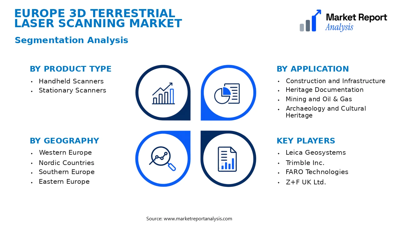
- Product Type
- Handheld Scanners: These portable devices are designed for quick, flexible scanning tasks in both outdoor and indoor environments, gaining demand in construction, archaeology, and preservation projects requiring mobility and ease of use.
- Stationary Scanners: High-precision, fixed scanners suitable for detailed, large-volume data collection in applications like infrastructure assessment, mining, and large-scale surveying, often preferred for their enhanced accuracy and speed.
- Application
- Construction and Infrastructure: This segment widely employs terrestrial laser scanning for structural analysis, site documentation, and progress monitoring, driven by the need for precise, real-time structural insights that improve project efficiency.
- Heritage Documentation: Uses high-resolution scans to digitally archive and restore historical sites and artifacts, with growing adoption due to advancements in imaging technology and the importance of preservation efforts.
- Mining and Oil & Gas: Utilizes laser scanning for volumetric measurements, safety assessments, and infrastructure mapping, critical for optimizing operations and ensuring compliance with safety standards.
- Archaeology and Cultural Heritage: Engaged in detailed site mapping, artifact recording, and virtual restoration, supported by the non-invasive, high-accuracy data capture capabilities of terrestrial laser scanners.
- Geography
- Western Europe: Encompassing highly developed markets like Germany, France, and the UK, this region exhibits robust adoption owing to mature construction, infrastructure, and cultural heritage sectors pushing demand for advanced scanning solutions.
- Nordic Countries: Features early adoption and high technological integration, with a focus on environmental monitoring, archaeology, and infrastructure, supported by strong government support for technological innovation.
- Southern Europe: Markets such as Spain, Italy, and Greece are experiencing growth driven by tourism, archaeological projects, and infrastructure modernization, augmenting the need for accurate, mobile laser scanning tools.
- Eastern Europe: Characterized by emerging markets where adoption rates are increasing due to infrastructure development, industrial expansion, and increasing awareness of digital mapping benefits.
Competitive Intelligence
The Europe 3D Terrestrial Laser Scanning Market exhibits a competitive landscape characterized by moderate to high market concentration, with key players including Leica Geosystems, Faro Technologies, and Trimble dominating the sector. These companies implement aggressive business strategies centered around product innovation, strategic partnerships, and geographical expansion to sustain competitive advantages. Product differentiation is primarily achieved through advancements in scan accuracy, processing speed, and integration capabilities with GIS and BIM platforms. In addition, firms are increasingly engaging in mergers and acquisitions to expand their technological portfolios and market reach across Europe. R&D investments focus on developing lightweight, portable scanners and enhancing data processing algorithms, which set participants apart in terms of performance and reliability. Collaborations with infrastructure, construction, and surveying firms facilitate the integration of cutting-edge solutions, further strengthening their market position. The emphasis on innovation and strategic growth initiatives underscores a highly dynamic competitive environment aimed at capturing the expanding demand for 3D terrestrial laser scanning across various industry verticals in Europe.
Leading Company Profiles
The competitive landscape of Europe’s 3D terrestrial laser scanning market is comprised of innovative firms that lead in technology, strategic expansion, and customer support. These players shape the market dynamics and drive technological advancements across various industry segments.
- Leica Geosystems
- Trimble Inc.
- FARO Technologies
- Z+F UK Ltd.
- Topcon Positioning Systems
- Riegl Laser Measurement Systems
- Sarada Laser Scanning
- Spar3D Spatial
- GeoSLAM Ltd.
- Infrared Integrated Systems
Leica Geosystems
Leica Geosystems specializes in high-precision laser scanning and imaging solutions designed for surveying, engineering, and construction projects, boasting advanced 3D data acquisition and processing capabilities that facilitate precise, real-time results.
Trimble Inc.
Trimble offers comprehensive geospatial and 3D laser scanning systems, focusing on integration with GPS technology and software solutions, enabling mobile and stationary data collection tailored to diverse industrial needs across Europe.
FARO Technologies
FARO is known for its fast, accurate portable laser scanners and positioning systems with a strong emphasis on architectural, forensic, and manufacturing inspection markets, continuously innovating with integration of AI and digital twin functionalities.
Z+F UK Ltd.
Z+F UK specializes in 3D laser scanners and positioning systems suitable for construction, industrial, and defense applications, prioritizing automation and enhanced data accuracy via cutting-edge hardware and cloud-based analytics platforms.
Topcon Positioning Systems
Topcon’s laser scanning portfolio focuses on construction, engineering, and geospatial markets, with a strategic emphasis on seamless integration with GIS and CAD systems to streamline workflows and improve project accuracy.
Riegl Laser Measurement Systems
Riegl develops high-performance lightweight laser scanners used primarily in terrestrial, UAV, and mobile mapping applications, focusing on innovation in pulse laser technology for detailed, high-resolution terrain and structural data collection.
Sarada Laser Scanning
Sarada provides specialized laser scanning solutions with an emphasis on archaeological, historical, and cultural monument preservation, integrating high-end accuracy with digital archiving technologies for long-term conservation efforts.
Spar3D Spatial
Spar3D offers advanced 3D spatial management software solutions that complement laser scanning hardware, emphasizing real-time data visualization, analytics, and cloud-enabled collaboration to improve decision-making processes.
GeoSLAM Ltd.
GeoSLAM focuses on lightweight, portable laser scanners optimized for rapid, extensive surveys in complex indoor and outdoor environments, emphasizing ease of use, mobility, and data integration with GIS platforms.
Infrared Integrated Systems
Infrared Integrated Systems develops tailored laser scanning and imaging solutions for industrial, security, and surveillance applications, emphasizing robustness, real-time data streaming, and compatibility with automation systems.
Strategic Business Developments

- April 2023 – Leica Geosystems – Launch of the BLK360 Smart Imaging Laser Scanner – Enhances data capture efficiency, offering high-precision 3D imaging suitable for detailed interior and exterior surveys across construction and heritage preservation sectors.
- June 2023 – Trimble Inc. – Capacity expansion in European laser scanner manufacturing facilities – Strengthens local supply chain capabilities, reduces delivery times, and supports increased adoption of integrated geospatial solutions.
- August 2023 – Faro Technologies – Introduction of the Focus S series with AI-enabled real-time analytics – Provides users with advanced environment mapping and data interpretation, boosting productivity in industrial and forensic applications.
- January 2024 – Z+F UK Ltd. – Strategic alliance with a major construction enterprise for integrated digital twin solutions – Facilitates real-time site monitoring and project management, securing longer-term contracts with leading infrastructure developers.
- March 2024 – Riegl Laser Measurement Systems – Acquisition of a European UAV mapping firm – Extends Riegl’s market reach into drone-based high-resolution terrain mapping, expanding its integrated product ecosystem, and broadening application scope.
Frequently Asked Questions
What is the Europe 3D Terrestrial Laser Scanning Market?
The Europe 3D Terrestrial Laser Scanning Market encompasses the industry involved in the development, manufacturing, and deployment of laser scanning technology for terrestrial applications across Europe. It includes hardware, software, and service providers delivering 3D spatial data capture solutions for various sectors such as construction, archaeology, and infrastructure.
What is the current market size of Europe 3D Terrestrial Laser Scanning Market?
As of 2026, the market size for Europe 3D Terrestrial Laser Scanning is valued at approximately USD 1.2 Billion. The market has experienced steady growth driven by increasing infrastructure projects and technological advancements in laser scanning systems across the region.
What factors are driving the Europe 3D Terrestrial Laser Scanning Market?
Key drivers include urban development projects, digital twin adoption, safety enhancements in construction, and the need for detailed 3D spatial data in archaeological and environmental studies. Technological improvements like mobile laser scanning and integration with BIM also boost market growth.
Which region dominates the Europe 3D Terrestrial Laser Scanning Market?
Western Europe leads the market, primarily fueled by robust infrastructure investments in countries such as Germany, France, and the UK. These regions demonstrate high adoption rates of advanced laser scanning technologies for various practical applications.
Which segment is expected to grow the fastest?
The software segment is projected to experience the highest growth, driven by increasing demand for data processing, analysis, and visualization tools. This segment is vital in converting raw laser scan data into actionable insights across industries.
Who are the leading companies operating in the Europe 3D Terrestrial Laser Scanning Market?
Major players include Leica Geosystems, Trimble Inc., Faro Technologies, and Topcon Corporation. These companies sustain competitive advantages through innovation, strategic partnerships, and extensive service networks across Europe to capture regional market opportunities.
Analyst Perspective
The Europe 3D Terrestrial Laser Scanning Market exhibits a mature yet evolving landscape with significant long-term growth prospects. As technological advancements continue to enhance scanning accuracy, speed, and data integration, the market is poised to unlock new commercial opportunities across infrastructure, heritage conservation, and urban planning sectors. Investment priorities should focus on innovative hardware development, AI-driven data processing, and interoperability standards to maintain competitive advantage. The region's growth potential remains robust due to ongoing urbanization, large-scale infrastructure projects, and increased governmental investments in smart city initiatives. Competitive intensity is expected to intensify as established players expand portfolios and new entrants leverage technological breakthroughs. Strategically, firms should emphasize regional differentiation, forge strategic partnerships, and prioritize R&D to capitalize on evolving market demands. In the long term, positioning around emerging technologies such as cloud-enabled analytics and automation will be critical for sustaining growth, while monitoring regulatory shifts and regional policies will be essential for risk mitigation.
